Sample Processed Data Sets
Mt. Saint Helens, Washington
| SourceForge Project |
| Downloads |
| Forums |
| Joe's Java Library |
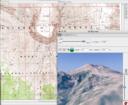
This is a small processed data set, consisting of a single DEM, single DLG and a single topographic DRG layer. The DEM and DLG are in Virtual Hiker's native "mapz" format. The DRG is in Virtual Hiker's custom tiled image format. This map set also contains an optional Landsat7ETM DRG map layer (you can use the "Merge" command to overlay the Landsat7 layer on top of the other map layers). I have also included two texture maps for the 3D view: a Landsat7ETM based texture and a topographic map based texture.
